Did you know Clontarf once played a frontline role during WWII?
Clontarf is often framed as relaxed waterfront living — Pelican Park, wide streets, sea breezes. But did you know that during the crisis year of 1942, its position at the entrance to the Redcliffe Peninsula gave it strategic relevance?
Queensland became a frontline staging ground in the Pacific War. Military bases, ports and airfields across the state supported Allied operations in the southwest Pacific. After the bombing of Darwin in February 1942, invasion fears intensified and infrastructure across Queensland was mobilised for defence. An estimated 95% of rail traffic north of Brisbane carried troops and supplies during this period.
In that environment, transport corridors mattered.
After Darwin was bombed, invasion preparedness became part of everyday life. Households received defence booklets and rumours of a so-called “Brisbane Line” — a theory that northern Australia might be abandoned to defend the south — circulated widely. Whether strategic reality or wartime rumour, the fear was real. Coastal access routes were no longer just infrastructure. They were strategic assets.
Why the Clontarf bridge mattered
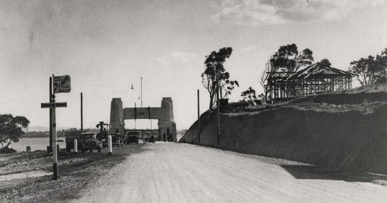
The Hornibrook Highway Bridge opened in 1935, linking Brighton directly to Clontarf. For the first time, the Peninsula had a permanent road connection to Brisbane.
During WWII, the Highway played an important strategic role, with military road convoys using the route to move war material efficiently to points in Queensland.
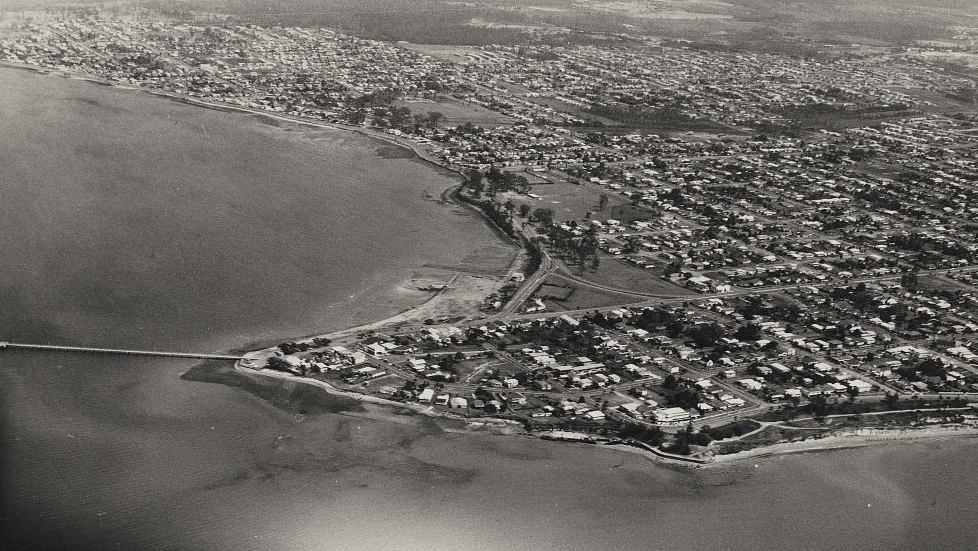
Photo Credit: Redcliffe Library Photographic Collection/ RLPC-000\000341
This is the critical link to Clontarf.
Clontarf was the physical landing point for that movement. Every convoy crossing the bridge entered the Peninsula through Clontarf. In a militarised Queensland — where roads, railways and ports were commandeered for defence logistics — reliable coastal access points formed part of the broader strategic network.
Clontarf’s geography positioned it not as a resort outpost, but as a corridor suburb.
That corridor logic shaped development patterns long after the war ended.
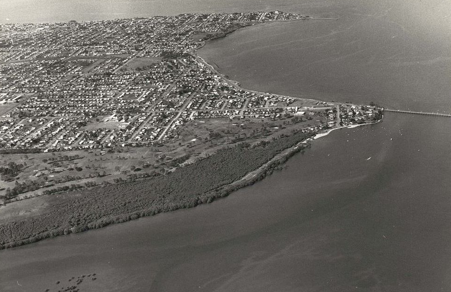
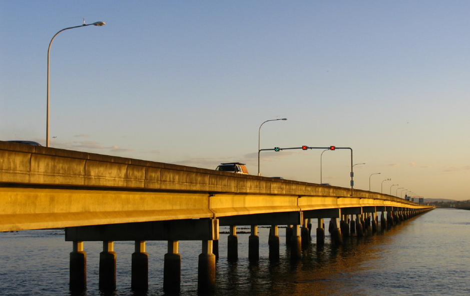
Photo Credit: Redcliffe Library Photographic Collection/ RLPC-002\002109
Access first. Lifestyle second.
Clontarf’s market behaviour continues to reflect its role as the Peninsula’s threshold suburb.
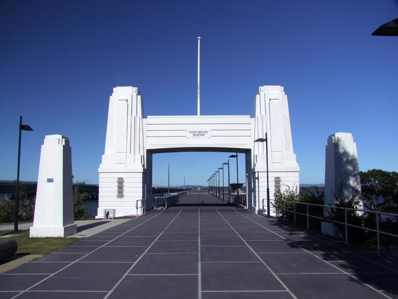
It is the first suburb reached when crossing from Brisbane, and that proximity to the bridge — historically the Hornibrook, now the Houghton Highway and Ted Smout Memorial Bridge — has influenced buyer demand for decades.
Unlike parts of central Redcliffe, Clontarf developed predominantly as a detached housing market with larger allotments and limited high-rise intrusion. The suburb reads as practical rather than vertical, with streets designed around family housing rather than apartment density.
That development pattern matters. It means Clontarf is typically valued for accessibility, block utility and everyday livability rather than skyline appeal or tourism intensity.
The result is a suburb where access drives confidence — and where land remains the dominant pricing factor.
What recent sales reveal about Clontarf’s positioning
Clontarf’s current market is operating firmly in owner-occupier territory, with land component value doing most of the heavy lifting.
• 83 Elizabeth Avenue — $1,510,000 — Sold 03 Dec 2025
• 14 Wendy Crescent — $1,360,000 — Sold 21 Nov 2025
• 3 Clontarf Avenue — $1,300,000 — Sold 21 Jan 2026
• 8 Wendy Crescent — $1,240,000 — Sold 04 Dec 2025
• 10 Kabura Street — $1,100,000 — Sold 11 Nov 2025
• 33 Essex Street — $1,050,000 — Sold 05 Dec 2025
• 332 Elizabeth Avenue — $980,000 — Sold 08 Dec 2025
• 17 Conley Street — $960,000 — Sold 14 Jan 2026
• 8 Ralph Street — $948,000 — Sold 11 Nov 2025
Several themes emerge.
• The $1 million threshold is now embedded. Seven of the nine listed sales exceeded $1 million, reflecting a mature owner-occupier market rather than speculative turnover.
• Street-level repetition signals pocket demand. Elizabeth Avenue and Wendy Crescent appear multiple times in the higher price range, suggesting buyers are targeting specific corridors that combine access, block size and neighbourhood stability.
• Detached housing dominance remains intact. There is no apartment influence in this sample. Clontarf continues to function as a land-based market consistent with its low-density planning history.
• The relatively tight price clustering — largely between $1.05 million and $1.36 million, with a top result above $1.5 million — suggests a suburb where land value and accessibility underpin pricing consistency.
The corridor logic still applies
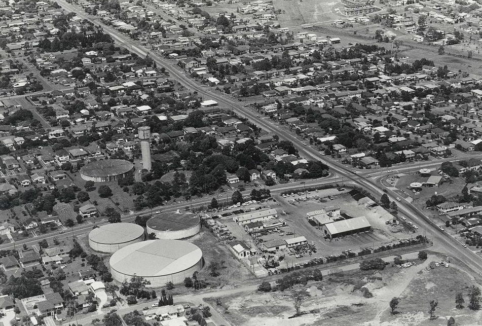
Photo Credit: Redcliffe Library Photographic Collection/RLPC-000\000350
Clontarf’s wartime relevance was not symbolic. It was functional. The bridge connection made it part of a strategic logistics network at a time when Queensland’s infrastructure was mobilised for defence.
Today the purpose is civilian rather than military, but the geography is unchanged.
Clontarf remains the Peninsula’s gateway suburb and the first point of entry from Brisbane. It operates as a predominantly low-density housing precinct where land value, accessibility and ease of movement underpin buyer confidence.
The bridge once carried war convoys. Today it carries commuters and families.
The strategic context has changed. The value of position has not.
Published 13 February 2026.
Featured Image Photo Credit: Redcliffe Library Photographic Collection/ RLPC-000\000601