
How Bongaree Became Bribie’s Most Walkable Suburb
Bongaree’s competitive edge is not cosmetic — it is structural. The suburb is built along the shoreline of Pumicestone Passage, and that geography has shaped how people move through it for more than a century. What reads today as “walkability” is the modern outcome of a waterfront settlement pattern that began with fishing fleets, oyster leases and ferry landings long before sealed roads and canal estates arrived.
Pumicestone Passage is a tidal strait — a protected marine corridor formed by ancient sand deposits — and its calm, shallow waters drew early commercial fishing activity to Bongaree’s foreshore. Post-war fishing shacks lined the waterfront; sand tracks substituted for formal streets; and oyster leases extended into the passage. The area’s working harbour character even supported a large pelican population, sustained by scraps from commercial fishermen.
The foreshore also carried strategic importance. During World War II, this stretch of coastline formed part of the defensive network across Moreton Bay, with observation posts and barriers installed amid fears of Japanese invasion. Movement along the water was practical, not recreational.
Access remained water-based until the Bribie Island Bridge opened in 1963, replacing regular ferries between Sandstone Point and Bongaree. The bridge shifted the island from seasonal retreat to permanent community, accelerating residential growth but preserving the linear waterfront structure established decades earlier.
That continuity explains Bongaree’s present-day advantage. The suburb’s key destinations — jetty, parks, retail core, schools and services — still align along the same foreshore corridor that once anchored fishing, defence and ferry transport. Walking here is not an afterthought. It is the legacy of how the place was built.
The foreshore remains the organising spine
Because Bongaree developed linearly along the passage, the waterfront is not just scenery. It is the suburb’s primary orientation point. Water sits on one side, residential streets on the other, with parks and civic spaces stitched between. That clarity makes the area easy to navigate on foot.
The long public edge around Pumicestone Passage functions as shared infrastructure. Bongaree Jetty remains a focal marker — historically for transport and fishing, now for recreation and community use. The alignment of parks, picnic areas and pathways along this corridor formalised what was already the natural movement route.
Heritage interpretation reinforces that linear structure. The waterfront plaques and the nearby Bribie Seaside Museum document the fishing industry, oyster farming, wartime installations and post-bridge residential shift. The designated heritage walk follows the same strip that once carried ferries and fishing vessels.
In practical terms, the foreshore links key destinations without requiring complex navigation. From the jetty area through Welsby Parade and south toward Brennan Park, the pathway network connects residential pockets to parks, retail and services in a straight line. That legibility is what makes everyday walking viable rather than symbolic.
Daily needs cluster in reachable, realistic trips
Walkability lives or dies on distance. If the essentials are too far apart, even the best footpaths won’t help. Bongaree’s key advantage is that many everyday destinations sit relatively close together: parks and the foreshore, a retail core, schools, and services.
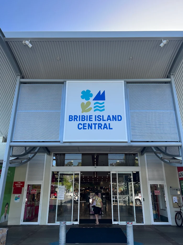
A practical anchor is Bribie Island Central on Goodwin Drive, with major stores like Woolworths and Target listed on the centre’s own information pages.
That means many errands can be split into short, manageable trips instead of a single “drive-and-park” trip. In walkable places, people shop differently: smaller, more frequent top-ups, and often on foot because it’s easy.
The underrated elements
A place can be technically walkable and still not feel walkable. What makes Bongaree effective for on-foot use is that it supports different walking speeds and needs: kids, older residents, visitors, people recovering from injury, and anyone who wants to pause.
Local foreshore parks provide the “support infrastructure” that turns a stroll into a habit:
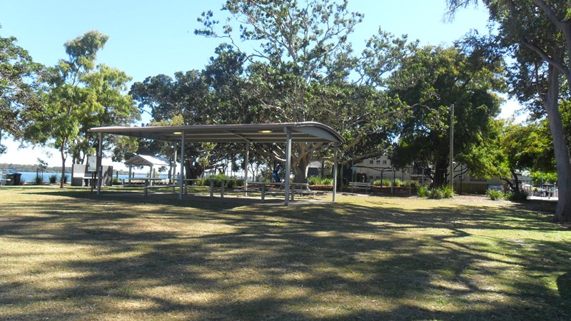
Brennan Park (near Bongaree Jetty) has electric barbecues, sheltered picnic tables, toilets, a playground, and open green space. Additions such as new playground equipment, park furniture, and a picnic shelter provide the kind of comfort features that keep people out longer.
Welsby Parade Park is specifically identified as a foreshore park providing access to Pumicestone Passage.
These features subtly remove friction. If you know there’s a toilet nearby, somewhere to sit, somewhere for kids to burn energy, walking becomes easy to say “yes” to.
Property sales signals from a suburb built for walking
A clear pattern emerges from Bongaree’s November 2025 to January 2026 sales window: buyers consistently paid more for homes that convert location into daily ease. Canal-front properties dominated the top tier, but so did addresses positioned within comfortable reach of the foreshore, parks and the retail core. The $2.5 million result at 9 Alstonia Court set the tone, with a cluster of sales between $1.6 million and $1.8 million reinforcing that lifestyle access, not just dwelling size, is driving premiums.
The strongest prices gravitated toward addresses that effectively extend the walking network to the water’s edge. Kristie Burley recently settled the sale of 225 Welsby Parade, Bongaree, a 4 bedroom, 3 bathroom house on 607m², for $2,200,000. At the top of the range, 9 Alstonia Court (5 bed, 3 bath, 800m²) sold for $2,500,000 through John Farren-Price, illustrating the upper boundary of that market. Just behind it, 75 Pentas Drive (4 bed, 2 bath, 800m²) sold for $1,750,000 via Carly Rowlands and Paul Blackledge, and 35 Pentas Drive (4 bed, 2 bath, 800m²) achieved $1,690,000 with Elena Stevens. These are not simply large homes. They are positioned to make waterfront access and relaxed foreshore movement part of everyday life.
Interestingly, the premium was not confined to absolute waterfront. 44 Hoya Crescent (4 bed, 2 bath, 901m²), sold for $1,800,000 through Beth Lagos, and 24 Jacaranda Drive (4 bed, 2 bath, 903m²), sold for $1,620,000 by Julian Ellis and Keith Wilkins, demonstrate how buyers value homes that sit inside Bongaree’s “easy distance” zone — close enough to walk to the passage, parks and services without the friction of long internal drives.
Further down the list, results such as 29 Ford Street at $1,300,000 and 2/6 Jasmin Drive at $1,120,000 show that the walkability effect scales. Even at lower price points, proximity and practicality hold weight. These homes may not be canal-front, but they still benefit from Bongaree’s compact layout, clustered amenities and foreshore backbone.
Taken together, the data suggests that Bongaree’s walkability is more than a lifestyle talking point. The market is consistently pricing in access — to water, to shops, to parks, to everyday routines. In a suburb where distances are realistic and movement feels natural, buyers are paying for the simplicity of being able to “walk down, walk home” without planning their day around the car.
Here are some of the highest recorded sales in that three-month window (highest to lowest):
- 9 Alstonia Court, Bongaree — $2,500,000, sold 21 Jan 2026
- 44 Hoya Crescent, Bongaree — $1,800,000, sold 14 Nov 2025
- 75 Pentas Drive, Bongaree — $1,750,000, sold 08 Nov 2025
- 35 Pentas Drive, Bongaree — $1,690,000, sold 21 Nov 2025
- 24 Jacaranda Drive, Bongaree — $1,620,000, sold 19 Nov 2025
- 29 Ford Street, Bongaree — $1,300,000, sold 06 Dec 2025
- 20 Burrawong Street, Bongaree — $1,140,000, sold 04 Dec 2025
- 2/6 Jasmin Drive, Bongaree — $1,120,000, sold 24 Dec 2025
- 18 Bestman Avenue, Bongaree — $1,115,000, sold 28 Nov 2025
- 76 Protea Drive, Bongaree — $1,100,000, sold 01 Dec 2025
Taken together, these results support Bongaree’s walkability advantage in the most practical way. The market pays more for places where daily life is simple. When foreshore paths and parks link up well, distances feel manageable, and services are relatively close, buyers don’t just like the lifestyle; they price it in.
Walking becomes social infrastructure
Some communities rely on scheduled events and formal venues to create connections. Bongaree can do that too, but in repeated, low-stakes encounters.
Bongaree even builds walking into its storytelling. Moreton Bay Libraries describe a “Plaques waterfront walk” in Bongaree, featuring 16 bronze heritage plaques along the waterfront walkway. Council promotes a Bongaree Heritage Walk that starts at Bongaree Jetty and explores the area’s history and heritage buildings—another reason to walk through the suburb rather than by car.
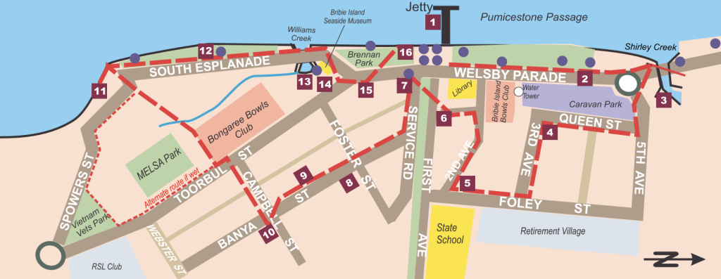
Bongaree Heritage Waterfront Walk – Key Stops
- Bongaree Jetty
- Welsby Parade
- Shirley Creek Bridge
- The Hill
- Bowlers Hostel
- First Avenue
- Bribie’s First Shop
- Banya – The Grand Street
- Coungeau House
- Davies Novelty Gardens
- Amateur Fisherman’s Association of Queensland
- South Esplanade
- Williams Creek
- Bribie Seaside Museum & Memorial
- Brennan Park and Shops
- Pioneer’s Heritage Plaque
Health is the obvious benefit
Walkability usually gets sold as “healthy lifestyle,” and yes, if the pleasant choice is the active choice, people naturally move more. But the deeper benefit is independence, especially across decades of life.
The ABS 2021 QuickStats list Bongaree’s median age as 67. In a community with a large older population, a walkable layout isn’t a luxury. It’s what keeps everyday life manageable: staying mobile without needing to drive everywhere, staying socially connected without arranging constant transport, keeping simple routines—coffee, park, foreshore—consistent and consistent.
For younger households, it’s easier family logistics, less time buckling kids into car seats, more opportunities for kids to move and play, and a more natural sense of neighbourhood.

Can you live car-light in Bongaree?
Many residents still drive—especially commuters heading off-island—but Bongaree can make it easier than most suburbs to reduce car dependence for local living.
Translink’s Route 640 timetable includes a stop at “Fortune Ave at Bribie Island Central, Bongaree”, and the stop information page lists multiple routes servicing that stop.
The key point: even if you keep a car, Bongaree can help you use it less, which changes cost, stress, and time.
What day-to-day living can look like
If you’re moving to Bongaree, the best way to picture it is to imagine your “ordinary Tuesday.”
- Morning: foreshore walk and coffee. Parks make it easy to stop, sit, talk, watch the water.
- Midday: quick essentials trip—Bribie Island Central is a genuine local hub, not just a corner store.
- Afternoon: school run and sport routines can be local too. Bribie Island State School and Bribie Island State High School are both on First Avenue, Bongaree, which reduces “cross-town” commuting within the island.
- Evening: sunset by the passage, or a slow loop that turns into catching up with someone you didn’t plan to see.
That pattern is how walkable suburbs quietly change lifestyles: you get more “life” without adding more “effort.”
Bongaree makes the suburb feel alive
Walkable places have a heartbeat. More people outside means more natural safety, more small-business energy, more spontaneous connection, more reasons to feel like you belong.
Bongaree’s layout helps turn movement into daily life. That’s why Bongaree doesn’t just look good in listing photos. It lives well.
If you want a suburb that makes it easier to be healthy, social, and independent. Bongaree’s walkability isn’t a side feature. It’s one of the main reasons the suburb works.

Featured Image Credit: Dhaval Cosai/Google Maps