How Woorim’s Wartime Role Shaped Bribie Island’s Community
Did you know that the surf beach at Woorim, now one of Bribie Island’s most sought-after coastal locations, was once part of a wartime defence network protecting the entrance to Moreton Bay?
Today, Woorim is best known as the surf-beach suburb of Bribie Island, attracting residents and visitors for its ocean frontage, golf course and relaxed coastal lifestyle.
During World War II, however, the same coastline formed part of a network of observation points, training grounds and coastal patrol areas designed to monitor maritime approaches to the bay.
At the time, Brisbane had become an important Allied logistics hub in the Pacific theatre. Protecting shipping routes and coastal access to the city became a strategic priority.
Bribie Island’s geography made it useful for that task. Long ocean beaches, elevated dune systems and flat terrain allowed military planners to establish surveillance points and training areas across the island.
The communities that exist today in Woorim, Bellara and Bongaree sit within a landscape that once served this broader defensive role.
QUICK LINKS TO SECTIONS BELOW
- Woorim: The Oceanfront Defense Position
- Bongaree: The Island’s Wartime Getaway
- WWII Fortifications on Bribie Island
- From Defence Landscape to Coastal Community
- Why History Still Shapes Woorim Today
Property Activity Across Woorim, Bellara and Bongaree
As Bribie Island evolved from a sparsely populated wartime landscape into a residential coastal community, housing gradually expanded across the island’s main settlements.
Together, Woorim, Bongaree and Bellara form the core residential area of Bribie Island, with a combined population of 13,708 residents according to 2021 census data from the Australian Bureau of Statistics.
Recent sales across these suburbs highlight the continued demand for homes within this unique island setting.
Top 10 Recent Sales
- 9 Alstonia Court, Bongaree — $2,500,000 — sold 21 Jan 2026
- 225 Welsby Parade, Bongaree — $2,200,000 — sold 3 Feb 2026
- 54 Rickman Parade, Woorim — $2,000,000 — sold 22 Dec 2025
- 45 Sixth Avenue, Woorim — $1,610,000 — sold 10 Dec 2025
- 37 Clement Street, Woorim — $1,590,000 — sold 17 Feb 2026
- 30 Winnett Street, Woorim — $1,590,000 — sold 31 Dec 2025
- 55 Oleander Drive, Bongaree — $1,300,000 — sold 8 Dec 2025
- 29 Ford Street, Bongaree — $1,300,000 — sold 6 Dec 2025
- 7 Winnett Street, Woorim — $1,140,000 — sold 22 Dec 2025
- 20 Burrawong Street, Bongaree — $1,140,000 — sold 4 Dec 2025
While today’s buyers are drawn by coastal lifestyle, these same suburbs sit within a landscape that once hosted defence installations, training grounds and wartime logistics across Bribie Island. It is a reminder of how the island’s geography has long shaped its development.
Standout Sales
The $2.5 million sale at 9 Alstonia Court, Bongaree (5 bed, 3 bath), handled by Keith Wilkins, highlights the continued appeal of large family homes in established residential pockets of Bongaree. The suburb has long functioned as Bribie Island’s township centre, and properties within easy reach of the foreshore along Pumicestone Passage remain attractive to buyers seeking permanent coastal living.
A short distance along the waterfront, 225 Welsby Parade, Bongaree sold for $2.2 million through Kristie Burley. The four-bedroom, three-bathroom home sits on one of the island’s best-known passagefront addresses, where uninterrupted water views and proximity to the Bongaree foreshore reinforce the suburb’s role as the island’s civic and lifestyle hub.
On the ocean side of the island, 54 Rickman Parade, Woorim reached $2 million through Sheri Binzer and Julie Walton. The two-bedroom, one-bathroom property reflects the scarcity of homes near the surf beach. As Bribie Island’s only suburb facing the open ocean, Woorim offers a different coastal experience from the calmer passage-side communities, helping sustain strong demand for properties within walking distance of the beach.
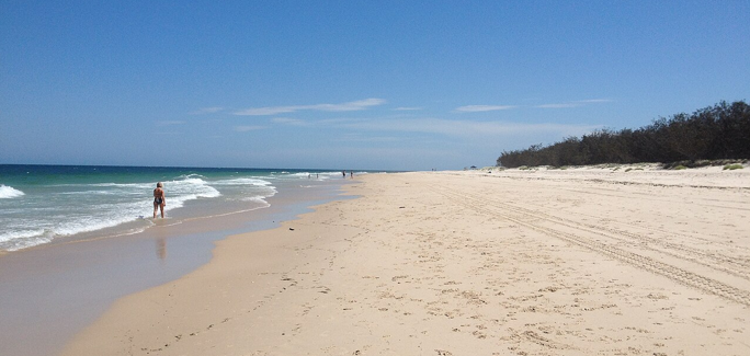
Woorim: The Oceanfront Defence Position
The eastern side of the island around Woorim hosted the most visible wartime activity.
The elevated dune systems north of Woorim provided clear sightlines across the ocean approaches to Moreton Bay, making the area suitable for coastal observation posts during the war.
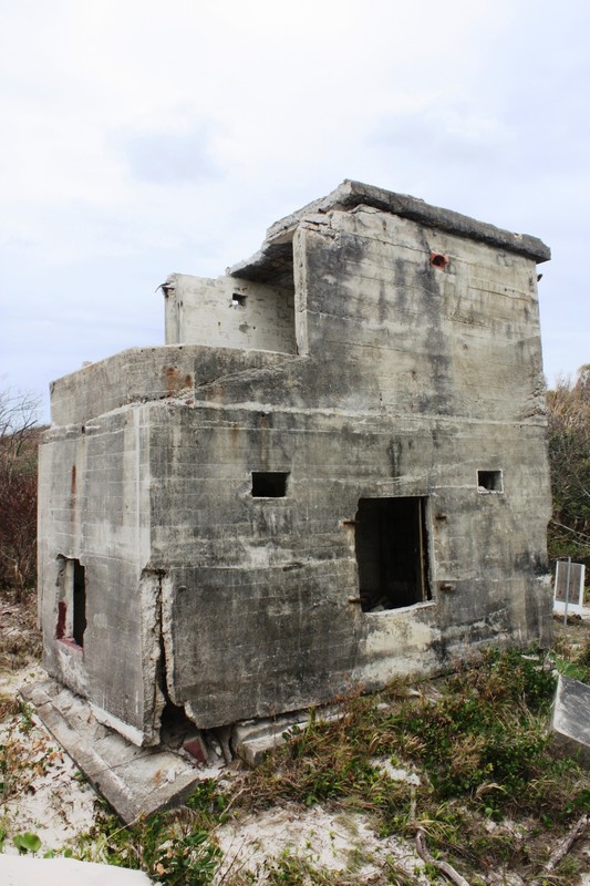
Photo Credit: Queensland Heritage Register
Several documented features illustrate how the area was used during the war.
Coastal artillery positions
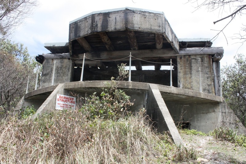
Photo Credit: Queensland Heritage Register
Defensive gun emplacements were constructed along sections of the coastline to monitor shipping movements and protect the northern entrance to the bay.
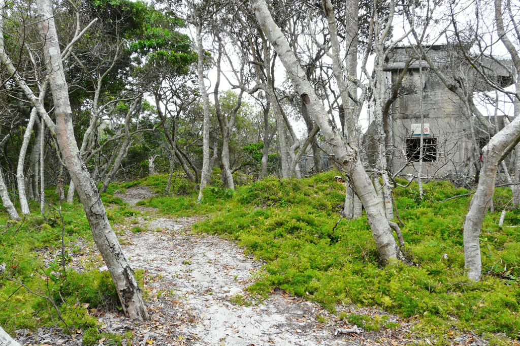
Camouflaged bunkers
Concrete bunkers were built into the dunes and covered with vegetation to reduce their visibility from the sea and the air.
Training grounds for defence exercises
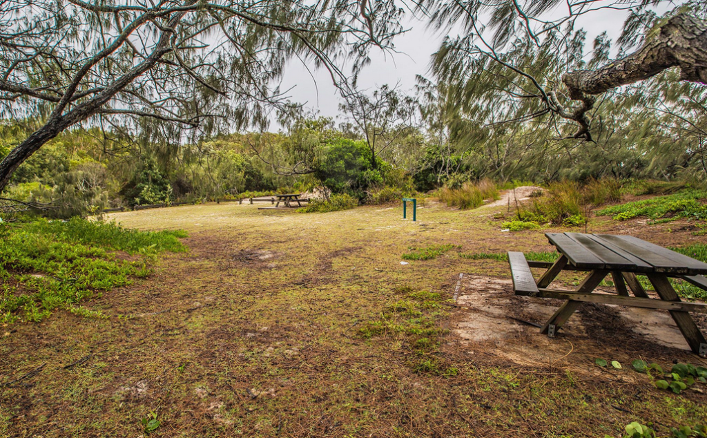
The wide, flat beaches north of Woorim allowed the area to be used for military drills, coastal patrol exercises and simulated defence scenarios.
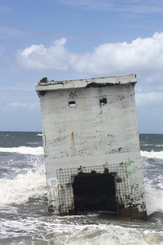
Photo credit: Queensland heritage Register
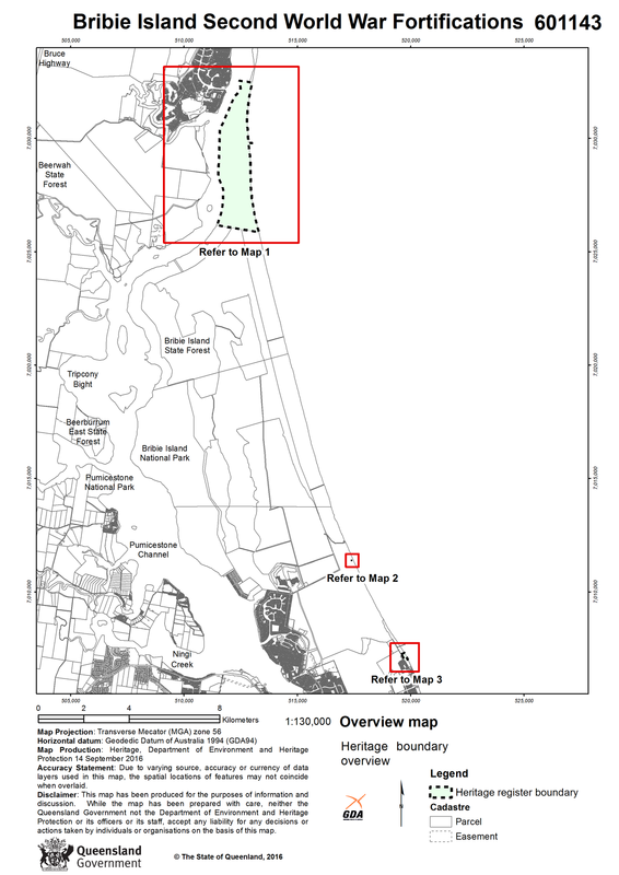
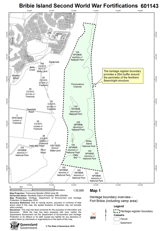
North of Woorim, parts of what is now Bribie Island National Park contain remains of the Fort Bribie coastal battery, which is listed on the Queensland Heritage Register. The installation formed part of the wartime coastal defence network protecting Brisbane and the entrance to Moreton Bay.
Bongaree: The Island’s Wartime Gateway
While the ocean side of Bribie Island around Woorim hosted defence installations and training activity, the island’s small township at Bongaree played a supporting role during the war.
At the time, Bongaree was the primary settlement on the island and served as the main point of access from the mainland. Personnel, equipment and supplies were transported across Pumicestone Passage before moving across the island toward the coastal training areas.
Nearby bushland areas that now form part of Bellara remained largely undeveloped during the early 1940s. These interior routes helped connect the township with the defence sites positioned along the ocean side of the island.
Although the island’s population was small during the war years, the presence of military personnel and training exercises briefly transformed what had previously been a quiet fishing and holiday destination.
World War II Fortifications on Bribie Island
From Defence Landscape to Coastal Community
With the end of World War II, the military activity that had briefly reshaped parts of Bribie Island gradually disappeared.
Defence installations along the ocean side of the island were dismantled or abandoned, and the dune systems north of Woorim returned largely to their natural state.
In the decades that followed, Bribie Island began evolving from a small wartime outpost into a recreational destination for residents of Brisbane and surrounding regions.

Photo credit: Caboolture Library Photographic Collection / CLPC-P1249
A turning point came in 1963 with the opening of the Bribie Island Bridge, which provided permanent road access between the mainland and the island. Improved accessibility accelerated tourism, holiday housing and residential development across the island’s main communities.
Why History Still Shapes Woorim Today
Although the wartime infrastructure has largely disappeared, the geography that made Woorim strategically useful in the 1940s remains unchanged.
The suburb sits on a narrow stretch of land between the Pacific Ocean and protected conservation areas within Bribie Island National Park. This physical setting limits large-scale development and helps preserve the open coastal character that attracts many residents to the area today.
Census data from the Australian Bureau of Statistics highlights the island’s lifestyle demographic profile. The median age across the three suburbs is relatively high. It is 60 in Woorim, 67 in Bongaree and 59 in Bellara, reflecting Bribie Island’s long-standing appeal as a retirement and downsizer destination.
Housing tenure data further reinforces the suburb’s stable residential base. ABS figures show that about two-thirds of occupied private dwellings in Woorim are owner-occupied, indicating a relatively high level of long-term residency.
For buyers, the appeal of the island lies in its combination of landscape, lifestyle and local history. The same coastal geography that once supported defence planning now shapes one of the Moreton Bay region’s most distinctive residential communities.
Published 6-March-2026
Featured Image: Wikimedia Commons/Chris Olszewski CCBY SA 3.0