A New Foreshore Map for Beachmere: Balancing Lifestyle and Conservation
It’s 6:30 p.m., the sky a soft wash of pink over the tidal flats at Beachmere foreshore. A couple of dogs paddle at the water’s edge, a horse moves quietly along the sand, and shorebirds — tiny silhouettes against the wet flats — probe for food under the fading light. Soon, new signs at beach access points will guide where each of them can roam. From 1 December 2025, the foreshore will follow a new map of recreation zones designed to protect shorebird habitat while maintaining public access.
Why this strip of sand matters so much
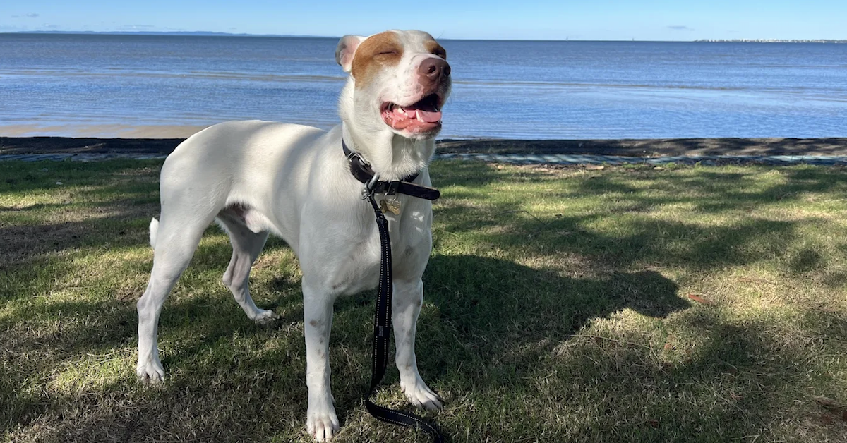
Beachmere is one of those quietly cherished coastal pockets where local streets spill onto wide tidal flats, and the water sets the rhythm of daily life. For many, it’s a favourite place for strolls, dog walks and the occasional horse ride.
It’s also an essential location for wildlife. Migratory and resident shorebirds rely on this foreshore to rest and feed, with some species travelling extraordinary distances — from places as far as Siberia and Alaska — before touching down on Moreton Bay’s tidal edges each year. What looks like an ordinary beach to many is part of an internationally recognised network of resting and feeding sites for these birds.
A new map for dogs, horses and walkers
Following community feedback, environmental assessments and consultation with the Kabi Kabi People’s Aboriginal Corporation, the City of Moreton Bay has updated the foreshore recreation areas to improve protection for shorebirds while keeping the coastline accessible.
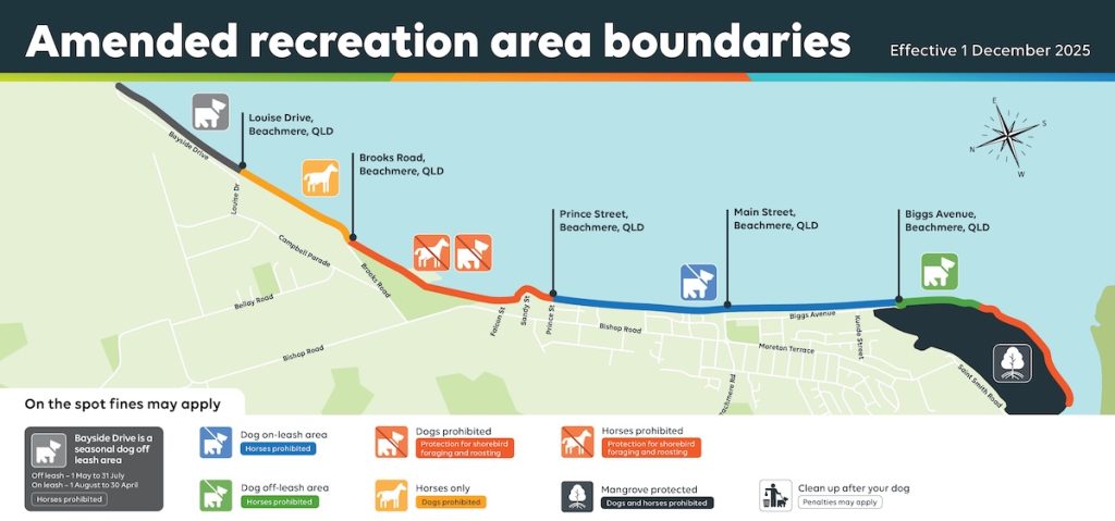
Here is how the revised layout works:
- Southern Off-Leash Dog Area
A permanent off-leash area of approximately 13 hectares (at low tide) stretches from the southern end of Biggs Avenue, across from the car park, and south of the second footbridge. Dogs can continue to exercise off-leash in this popular zone. - Seasonal Dog Off-Leash Area (Bayside Drive)
The foreshore at Bayside Drive is designated off-leash from 1 May to 31 July, and on-leash from 1 August to 30 April, aligning recreation with the periods when shorebirds are most present. - Dedicated Horse Exercise Areas
Horse-only areas now run along the foreshore near Beachmere Conservation Park, including the stretch between the Louise Drive beach entry point and Brooks Road, providing a clear corridor for riders while separating horses from dog-use areas. - Dog On-Leash Recreation Area
Between Biggs Avenue and Prince Street — and again from Prince Street to the southern end of Biggs Avenue — dogs must remain on-leash. These sections reduce disturbance and help create calmer zones for walkers and wildlife.
New signage at beach access points is being installed as part of Council’s broader community-education effort to help locals and visitors adjust to the updated zones.
Protecting lifestyle and liveability for the long run
People drawn to Beachmere often value its natural environment, peaceful coastal lifestyle and pet-friendly atmosphere. The updated foreshore plan reinforces these qualities while strengthening the area’s long-term environmental resilience.
For residents, prospective buyers and renters, the changes signal a community committed to caring for its coastline. That sense of stewardship supports Beachmere’s ongoing liveability and the shared enjoyment of its natural assets.
The new foreshore plan is not a final destination but the next step in an ongoing conversation about how people and wildlife can share a dynamic coastline.

Featured Image Credit: JS (Isabelle)/Google Maps